Text Mapping as Modelling
DHSI Victoria June 10–14, 2019 / Øyvind Eide.
Fixed times Wednesday
- 10:00. What is a model (presentation and discussion)
- 14:30. Projekt status/presentations and discussions.
Link to exercises
Link to Google spreadsheet for selection of exercises. The document can be edited by all of you, also without logging into Google.
Login link to Omeka. You should all have received an invitations – if not please let me know.
Link to project blog. Follow the link and select 'Register' under 'Meta' to get an account and start posting.
Sources to exercises
Robinson Crusoe:
http://web.archive.org/web/20080915175855/http://etext.lib.virginia.edu/toc/modeng/public/DefCru1.html
Jane Eyre: http://web.archive.org/web/20080719001718/http://etext.lib.virginia.edu/toc/modeng/public/BroJanI.html
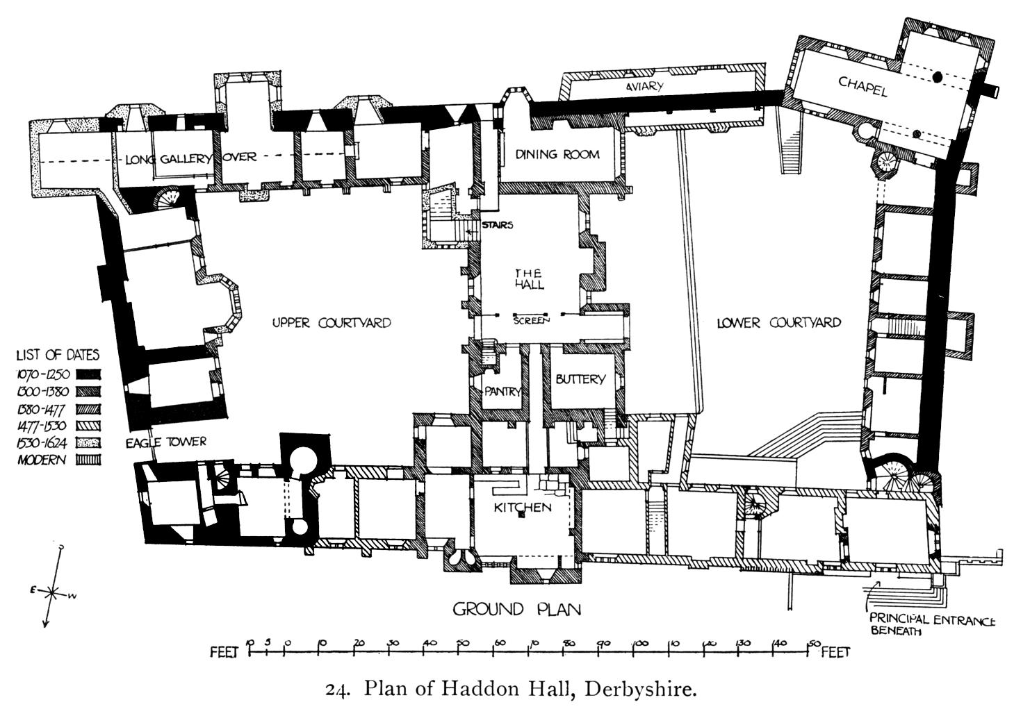
Haddon Hall: http://upload.wikimedia.org/wikipedia/commons/8/85/Haddon-Hall,-Derbyshire-q75-1459x1021.jpg
Frankenstein: http://www.gutenberg.org/files/84/84-h/84-h.htm
Ghosts: http://www.gutenberg.org/ebooks/8121
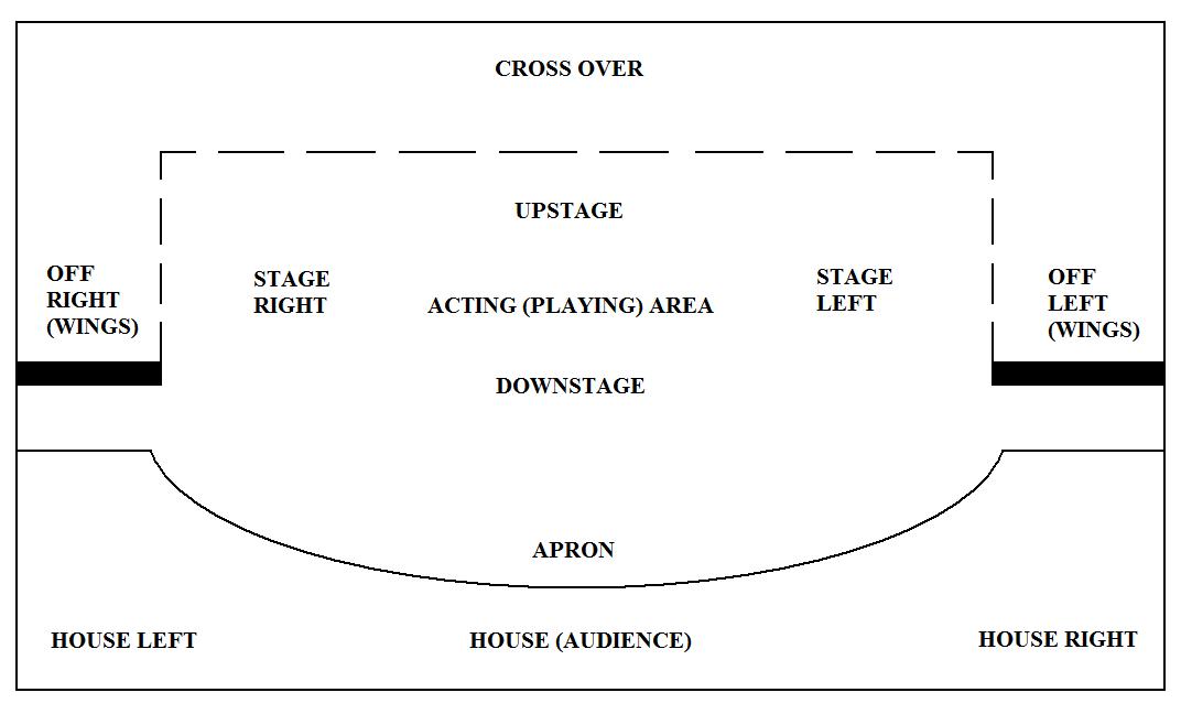
A theatre stage (example):
http://upload.wikimedia.org/wikipedia/commons/f/fa/Stage_Layout_Plan.jpg
The Killers: http://www.unz.org/Pub/Scribners-1927mar-00227
On Neatline
Forums » Neatline: Timeline etc.
Creating themes for individual Neatline exhibits. This lets you design the layout and appearance of one or more Neatline exhibitions. It does, however, involve writing css, php and javascript code on the server.
WMS-Layers
In order to have a WMS layer (geogreferred raster map) from the NYPL collection as background for your exhibitions, please follow these steps:
- Find the map here: http://maps.nypl.org/warper/maps?show_warped=1
- Choose Export and copy the WMS Capabilities URL.
- Open the Exhibit Settings for the exhibition you want the WMS layer in.
- Past into the WMS Address and then remove the question mark and everything after that. The result should be something like this: http://maps.nypl.org/warper/maps/wms/11925
- Write Map Warper WMS into the WMS Layers field and save
- In the exhibition, choose the map from the layers selector:

The same method should work for all rectified maps from https://mapwarper.net/ (see also below).
Rectification
In order to to have scanned maps connected to GIS systems and linked to other layers they must be rectified. This is a semi-automatic model for which there are both desktop tools (ArcGIS and QGIS can both be used) and online tools.
One example of an online tool: https://mapwarper.net.
Additional literature
- Tobias, T. N. (2009), Living proof: the essential data-collection guide for indigenous use-and-occupancy map survey, Ecotrust Canada & Union of British Columbia Indian chiefs, Vancouver.
- The moralised geography of Paradise Lost.
- Eide, Øyvind. Media Boundaries and Conceptual Modelling : Between Texts and Maps. Houndmills, Basingstoke, Hampshire: Palgrave Macmillan, 2015. Link to preprint version.
- Cooper, David, Christopher Donaldson, and Patricia Murrieta-Flores, eds. Literary Mapping in the Digital Age. Oxon and New York: Routledge, 2016
- Wood, D. (1993). "The fine line between mapping and mapmaking." Cartographica: The International Journal for Geographic Information and Geovisualization 30(4): 50--60.
- Wood, D. (1993). The Power of Maps. London, Routledge.
- Wood, D., et al. (2010). Rethinking the power of maps. New York, Guilford Press.
Last update 2019-06-15
Øyvind Eide